
Houses on the Prairie
The Sanborn Fire Insurance Map from 1896 provides an interesting snapshot of the patchwork early development of the area around Lyndale Street (then named Johnston Ave). In the area of the map shown here, Fullerton runs along the top and Milwaukee Ave is the diagonal street on the right. The California L station opened the year before this map was made, but Lyndale and portions of Belden and Palmer streets to the west and Stave street to the southeast were already densely lined with houses. The vacant lots along Kedzie Boulevard on the left as well as Palmer Square and Humboldt Boulevard below it were developed in the years from 1900 - 1915 after this map was created.
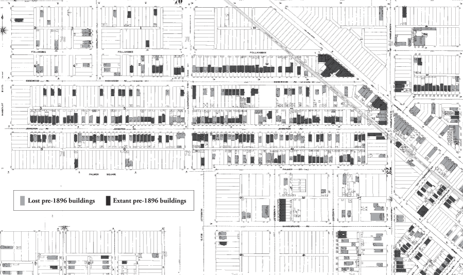
Map created by stitching together sections of the 1896 Sanborn Fire Insurance Map